Find
Report Feature Area
You can use the Report Feature Area tool to get the acreage of a selected layer contained within a designated Parcel.
The available layers include a mix of Base, Environmental, and Zoning polygon layers.
To open the Report Feature Area tool
- In the Tools tab of the Console, click the sub-category title bar Report Feature Area.
- The Report Feature Area box expands to open the dialog box to enter the PIN and select the layer to calculate acreage for.
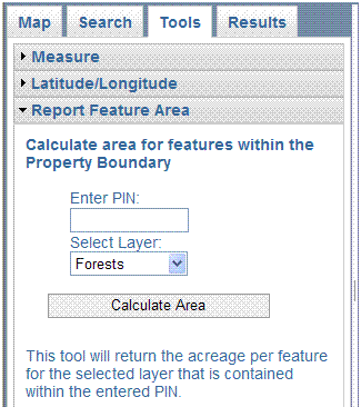
- Enter a PIN in the text box, then click in the Select Layer box and choose the
desired layer for acreage calculation. Forests, Flood Plains, Soils, Hydric Soils, Water Bodies, and Zoning
are the layers available for calculation.
- Click the Calculate Area button. The calculation results are displayed in the Results tab
and the features are outlined on the map. (Note: The calculation process may take several seconds to complete.)
- The Report Feature Area tool provides the PIN, total parcel area, and APPROXIMATE areas for the selected polyon features within the parcel.
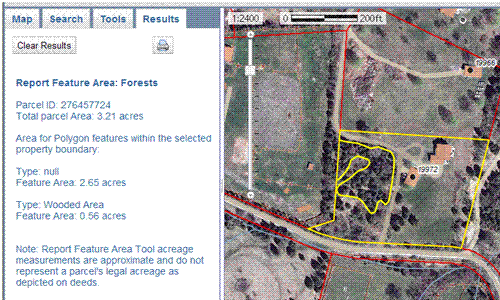
- This tools runs even if the feature type selected is not turned on in the Map Contents. Turn the layer on to view the feature locations on the map.