 next to a data group to display the layers within it.
A checkbox next to the layer indicates whether the layer is currently turned on.
next to a data group to display the layers within it.
A checkbox next to the layer indicates whether the layer is currently turned on.
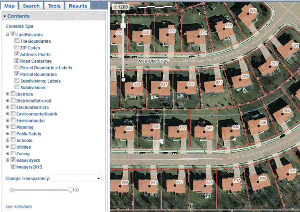
Map contents
This mapping application uses content sources called services. Each service contains one or more map layers. A map layer is a type of data shown on the map, such as roads, towns, or aerial imagery.
This mapping application allows you to view the list of the contents of the map, turn on and off layers, and examine the symbols for layers.
next to a data group to display the layers within it.
A checkbox next to the layer indicates whether the layer is currently turned on.
The map scale shown in the Map Screen is given in an absolute ratio of independent units. This means one unit on the map is equal to the corresponding number of the same units on the ground. For example, a scale of 1:32000 means that 1 inch = 32,000 inches or 1 foot = 32,000 feet depending on the unit used.
The following table provides a list of all of the map scales in the mapping application and their inch to feet equivalent for mapping purposes.
| Map scale | Inch to feet equivalent |
|---|---|
| 1:600 | 1"=50' |
| 1:1200 | 1"=100' |
| 1:2400 | 1"=200' |
| 1:4800 | 1"=400' |
| 1:7200 | 1"=600' |
| 1:16000 | 1"=1,333' |
| 1:32000 | 1"=2,667' |
| 1:64000 | 1"=5,333' |
| 1:125000 | 1"=10,417' |
| 1:250000 | 1"=20,833' |
| 1:400000 | 1"=33,333' |
| 1:500000 | 1"=41,667' |
Not all layers are visble at all scales. The following table provides a list of the data layers in the mapping application and their visible scales.
| Data category | Data layer | Visible scales |
|---|---|---|
| Land Records | Tile Boundaries | All scale levels |
| ZIP Codes | All scale levels | |
| Address Points | 1:600, 1:1200, 1:2400 | |
| Road Centerline | 1:600, 1:1200, 1:2400, 1:4800, 1:7200, 1:16000, 1:32000 | |
| Parcel Boundaries: Labels | 1:600, 1:1200, 1:2400, 1:4800, 1:7200, 1:16000 | |
| Parcel Boundaries | 1:600, 1:1200, 1:2400, 1:4800, 1:7200, 1:16000, 1:32000 | |
| Subdivisions: Labels | 1:600, 1:1200, 1:2400, 1:4800, 1:7200, 1:16000 | |
| Subdivisions | 1:600, 1:1200, 1:2400, 1:4800, 1:7200, 1:16000, 1:32000, 1:64000 | |
| Districts | Ag Districts | 1:600, 1:1200, 1:2400, 1:4800, 1:7200, 1:16000, 1:32000, 1:64000, 1:125000, 1:250000 |
| Airport Impact OD | All scale levels | |
| Spring Feature Protection | 1:600, 1:1200, 1:2400, 1:4800, 1:7200, 1:16000, 1:32000, 1:64000, 1:125000, 1:250000 | |
| Ridge Feature Protection | 1:600, 1:1200, 1:2400, 1:4800, 1:7200, 1:16000, 1:32000, 1:64000, 1:125000, 1:250000 | |
| Mountainside OD 1993 | 1:600, 1:1200, 1:2400, 1:4800, 1:7200, 1:16000, 1:32000, 1:64000, 1:125000, 1:250000 | |
| Historic Districts | 1:600, 1:1200, 1:2400, 1:4800, 1:7200, 1:16000, 1:32000, 1:64000, 1:125000 | |
| Historic Districts - Towns | 1:600, 1:1200, 1:2400, 1:4800, 1:7200, 1:16000, 1:32000, 1:64000, 1:125000 | |
| Quarry Notification OD | All scale levels | |
| Conservation Easements | 1:600, 1:1200, 1:2400, 1:4800, 1:7200, 1:16000, 1:32000, 1:64000, 1:125000, 1:250000 | |
| Reservoir Protection Area | 1:600, 1:1200, 1:2400, 1:4800, 1:7200, 1:16000, 1:32000, 1:64000, 1:125000 | |
| Rt 28 Tax District | All scale levels | |
| Rt 28 Elected OD | All scale levels | |
| Rt 28 Optional OD | All scale levels | |
| Village Conservation OD | All scale levels | |
| Steep Slope | 1:600, 1:1200, 1:2400, 1:4800, 1:7200, 1:16000, 1:32000, 1:64000, 1:125000 | |
| Subdivision Control Limits | All scale levels | |
| Limestone OD | All scale levels | |
| Districts Metrorail | Metrorail Stations: Labels | 1:600, 1:1200, 1:2400, 1:4800, 1:7200, 1:16000, 1:32000, 1:64000, 1:125000 |
| Metrorail Stations | All scale levels | |
| Metrorail Track | All scale levels | |
| Station Service Districts: Labels | 1:600, 1:1200, 1:2400, 1:4800, 1:7200, 1:16000, 1:32000, 1:64000, 1:125000 | |
| Station Service Districts | All scale levels | |
| Metrorail Service District | All scale levels | |
| Election Districts | Polling Places | All scale levels |
| VA House 2021 | All scale levels | |
| VA Senate 2021 | All scale levels | |
| VA House 2011 | All scale levels | |
| VA Senate 2011 | All scale levels | |
| Precincts | All scale levels | |
| Election Districts 2022 | All scale levels | |
| Election Districts 2011 | All scale levels | |
| Environmental Health | Cemetery: Labels | 1:600, 1:1200, 1:2400, 1:4800, 1:7200, 1:16000 |
| Cemetery | 1:600, 1:1200, 1:2400, 1:4800, 1:7200, 1:16000, 1:32000, 1:64000, 1:125000 | |
| Pollution Sources: Labels | 1:600, 1:1200, 1:2400, 1:4800, 1:7200, 1:16000 | |
| Pollution Sources | 1:600, 1:1200, 1:2400, 1:4800, 1:7200, 1:16000, 1:32000, 1:64000, 1:125000 | |
| Drainfields: Labels | 1:600, 1:1200, 1:2400, 1:4800, 1:7200, 1:16000 | |
| Drainfields | 1:600, 1:1200, 1:2400, 1:4800, 1:7200, 1:16000, 1:32000 | |
| Wells: Labels (some features internal only) |
1:600, 1:1200, 1:2400, 1:4800, 1:7200, 1:16000 | |
| Wells (some features internal only) |
1:600, 1:1200, 1:2400, 1:4800, 1:7200, 1:16000, 1:32000 | |
| Environmental | Soil Point Features | 1:600, 1:1200, 1:2400, 1:4800, 1:7200, 1:16000 |
| Soils | 1:600, 1:1200, 1:2400, 1:4800, 1:7200, 1:16000 | |
| Soil Drains | 1:600, 1:1200, 1:2400, 1:4800, 1:7200, 1:16000, 1:32000, 1:64000 | |
| Prime Farmland Soils (Cluster Option) | 1:600, 1:1200, 1:2400, 1:4800, 1:7200, 1:16000 | |
| Topography | 1:600, 1:1200, 1:2400, 1:4800, 1:7200, 1:16000 | |
| Virginia Scenic Rivers | All scale levels | |
| Floodplain | All scale levels | |
| Hydric Soils | 1:600, 1:1200, 1:2400, 1:4800, 1:7200, 1:16000, 1:32000, 1:64000, 1:125000 | |
| Watersheds | All scale levels | |
| Wetlands Model | 1:600, 1:1200, 1:2400, 1:4800, 1:7200, 1:16000, 1:32000, 1:64000 | |
| River and Stream Corridor Resources Min Width | All scale levels | |
| River and Stream Corridor Resources | All scale levels | |
| Forest | 1:600, 1:1200, 1:2400, 1:4800, 1:7200, 1:16000, 1:32000. 1:64000 | |
| Planning | CTP Roads (internal only) |
All scale levels |
| Traffic Analysis Zones (TAZ) | All scale levels | |
| Census - Tracts | All scale levels | |
| Census - Block Groups | All scale levels | |
| Census - Blocks | All scale levels | |
| Census - CDP | All scale levels | |
| Census - Towns | All scale levels | |
| Place Types | All scale levels | |
| Planning Subareas | All scale levels | |
| Policy Areas | All scale levels | |
| Suburban Communities 2001 | All scale levels | |
| Stormwater MS4 2020 | All scale levels | |
| Public Safety | Public Safety Station | All scale levels |
| Rural Water Supply | 1:600, 1:1200, 1:2400, 1:4800, 1:7200, 1:16000, 1:32000, 1:64000 | |
| Hamilton Fire Hydrants | 1:600, 1:1200, 1:2400, 1:4800, 1:7200, 1:16000, 1:32000 | |
| Leesburg Fire Hydrants | 1:600, 1:1200, 1:2400, 1:4800, 1:7200, 1:16000, 1:32000 | |
| Lovettsville Fire Hydrants | 1:600, 1:1200, 1:2400, 1:4800, 1:7200, 1:16000, 1:32000 | |
| Middleburg Fire Hydrants | 1:600, 1:1200, 1:2400, 1:4800, 1:7200, 1:16000, 1:32000 | |
| Purcellville Fire Hydrants (internal only) |
1:600, 1:1200, 1:2400, 1:4800, 1:7200, 1:16000, 1:32000 | |
| Round Hill Fire Hydrants | 1:600, 1:1200, 1:2400, 1:4800, 1:7200, 1:16000, 1:32000 | |
| Loudoun Water Fire Hydrants | 1:600, 1:1200, 1:2400, 1:4800, 1:7200, 1:16000, 1:32000 | |
| Fire Box Areas | All scale levels | |
| Fire First Due Area | All scale levels | |
| LCSO Patrol Sectors | All scale levels | |
| EMS First Due Areas | All scale levels | |
| Schools | School Sites | All scale levels |
| Zones - Elementary | All scale levels | |
| Zones - Middle | All scale levels | |
| Zones - High | All scale levels | |
| Utilities | Telecom Towers | All scale levels |
| Major Power Lines | All scale levels | |
| Stormwater BMPs | 1:600, 1:1200, 1:2400, 1:4800, 1:7200, 1:16000, 1:32000 | |
| Stormwater Structures | 1:600, 1:1200, 1:2400, 1:4800, 1:7200, 1:16000, 1:32000 | |
| Stormwater Pipes | 1:600, 1:1200, 1:2400, 1:4800, 1:7200, 1:16000, 1:32000 | |
| Loudoun Water Gravity Sewer (internal only) |
1:600, 1:1200, 1:2400, 1:4800, 1:7200, 1:16000, 1:32000 | |
| Loudoun Water Force Main (internal only) |
1:600, 1:1200, 1:2400, 1:4800, 1:7200, 1:16000, 1:32000 | |
| Loudoun Water Water Pipe (internal only) |
1:600, 1:1200, 1:2400, 1:4800, 1:7200, 1:16000, 1:32000 | |
| Zoning | Leesburg Zoning | 1:600, 1:1200, 1:2400, 1:4800, 1:7200, 1:16000, 1:32000, 1:64000, 1:125000 |
| 1972 Zoning Ordinance | All scale layers | |
| Zoning: Labels | 1:600, 1:1200, 1:2400, 1:4800, 1:7200, 1:16000, 1:32000, 1:64000 | |
| Zoning | All scale layers | |
| Rezoning - ZMAP: Labels | 1:600, 1:1200, 1:2400, 1:4800, 1:7200, 1:16000, 1:32000, 1:64000 | |
| Rezoning - ZMAP | All scale layers | |
| Zoning - 12/12/2023 (internal only) |
All scale layers | |
| 1/7/03 - 5/19/05 (internal only) |
All scale layers | |
| Pre - 1/7/03 (internal only) |
All scale layers | |
| Base Layers | County Boundary | All scale levels |
| Town Boundaries | All scale levels | |
| Major Roads | All scale levels | |
| Buildings | 1:600, 1:1200, 1:2400, 1:4800, 1:7200 | |
| Fences | 1:600, 1:1200, 1:2400 | |
| Road Casings | 1:600, 1:1200, 1:2400, 1:4800, 1:7200, 1:16000 | |
| Major Streams | All scale levels | |
| Base Map Drains | 1:600, 1:1200, 1:2400, 1:4800, 1:7200, 1:16000, 1:32000, 1:64000 | |
| Water Bodies | All scale levels | |
| Imagery | Imagery | All scale levels |