The Web Mapping Application page has four main parts:
- Links, along the top, to this Help, Contact Information, a Start Over button, and other Loudoun County websites.
- A Toolbar, above the Map Screen containing:
 Pan, or move, around map Pan, or move, around map Zoom in or Zoom in or  Zoom out Zoom out Zoom Full map extent Zoom Full map extent Zoom to previous extent or Zoom to previous extent or  Zoom to next extent Zoom to next extent Identify features Identify features Clear Map Clear Map Print Map Print Map Pictometry imagery Pictometry imagery
- Map Screen, on the right, shows the main map.
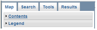
- Console, on the left, contains tabs for choosing Map layers, performing Searches, Tools to interact with the data, and viewing Results.
|
 to open and close the Overview Map window.