Find
Pictometry oblique aerial imagery
Use the Pictometry tool to get a better view of a location with oblique aerial images.
Note: Pictometry can be accessed from the Main Toolbar  Pictometry -or- in the Tools tab under Aerial Imagery.
To view Pictometry Imagery
- In the Toolbar, click the
Pictometry button.
- Or - in the Tools tab of the Console, click the title bar Aerial Imagery and select the Pictometry Oblique button.
- Click on the map to view Pictometry images for that location.
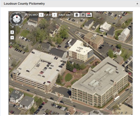
- Use the compass tool in the upper left to switch between oblique views or view from directly above.
- Use the left and right arrow buttons to view different shots and years of imagery.
- Click the
 Layers tool to turn on/off layers.
- Click the
 Export tool to export to PDF format.
- To close the Pictometry window click the close button
 in the upper right corner of the box.
- The Pictometry tool remains active until another tool is selected.